
Trailforks is a mobile app and desktop platform for mountain bike trails, routes, parking areas, shops and landowners that is user-maintained and built by Pinkbike.com
This site relies on Trailforks for our recommended routes. We have taken the time to map the trails and provide you the directions necessary for an awesome ride. Please use the app out in the field, to explore, and contribute trail status updates–our local club, the Santa Fe Fat Tire Society, uses that info to help maintain our trails. Show them support, if you can.
Get Started
Step One: download the Trailforks app on your mobile device. iOS or Android.
Step Two: Log in using your Pinbike username or create an account.
Step Three: Look for the Trailforks icon on our pages which will take you to the trail route page on Trailforks.
Step Four: Add route to Wishlist or select route. You can then explore the route on your phone.
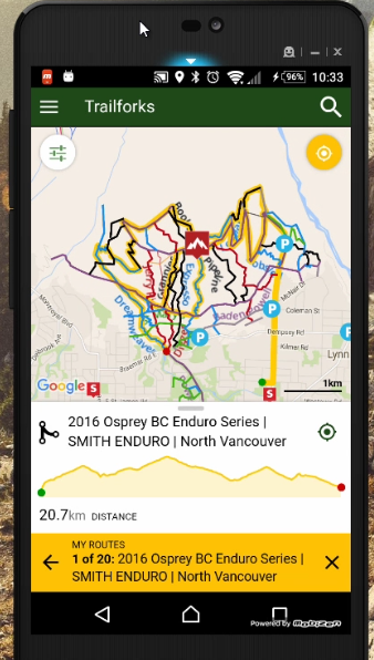
Route details and your GPS location 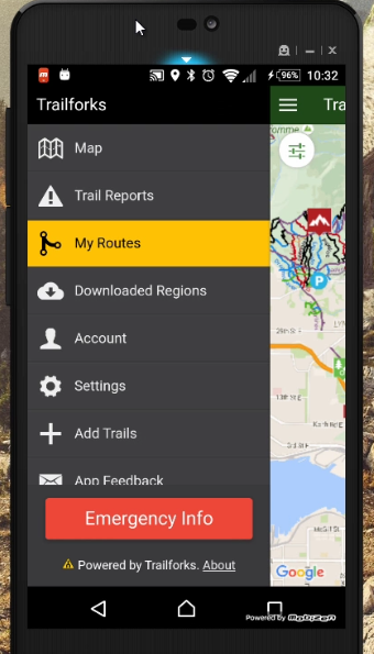
Your list of Wishlist routes.
Step Five: Go ride!
Maps and Trailheads
If utilizing a mobile app is not an option, we also will include a downloadable PDF option for each route. Look for the map icon to download the route.

While Dale Ball, La Tierra, and Galisteo Basin Preserve trails have signage at each intersection to help you along your way, the upper mountain trails have rudimentary markers, if any at all. We still highly recommend using an app.
To find the trailhead, each route has a Google Maps link you will see in the Ride section. Look for a hyperlink like Aspen Vista Trailhead, which will initiate Google Maps.
Trail Reports and Status
If you’re using Trailforks, you also have an option to post a trail report. These reports are extremely useful for our trail crews and other riders alike. If there a downed tree, fresh snow, or lots of mud, please report using the Trailforks Trail Report option:
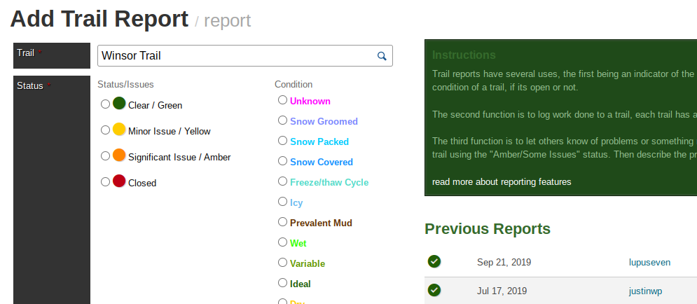
Given our sometimes schizophrenic weather, it helps all users to know what trails are riding well.